Another spot of geeking-out. After seeing a couple student pilot blogs with embedded maps of their flights (like this one), I wanted-in on the action. After some searching around, these maps have been created by SpiderTracks – a piece of hardware that provides live flight tracking facilities. At over £1000, I wasn’t exactly ready to hand over my cash, so I’ve been looking at cheaper solutions.
After lots of searching and thinking, I decided to try using my iPhone (with built-in GPS) and an app called MotionX-GPS, a £1.99 iPhone app with track recording features. I already had the app and had been using it for recording my hiking and walking in the hills, so I was familiar with how it worked and the accuracy had always been good, even when walking through dense forests without a clear line of sight to the GPS gods in the sky.
So, last lesson (lesson 6) I opened up MotionX-GPS and started recording my track as I got in to the plane. Lesson over, I pressed the stop button and saved my track to a GPX file. When I got home, I was able to import the GPX file in to Google Earth, which gives a pretty swanky visualisation of my route:
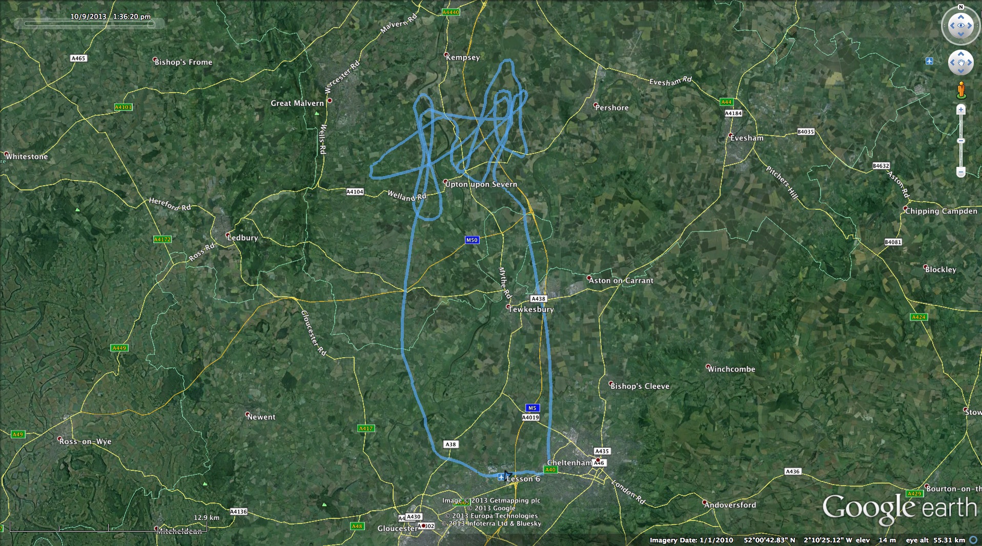
Google Earth even has a fancy ‘Play Tour’ option, which uses the timing data from the GPS file to recreate and play-back the entire flight in real-time (or speeded-up) using the usual 3D Google Earth style view. Finally, it also has a ‘Show Elevation & Speed Profile’ option, which generates this pretty cool interactive graph:
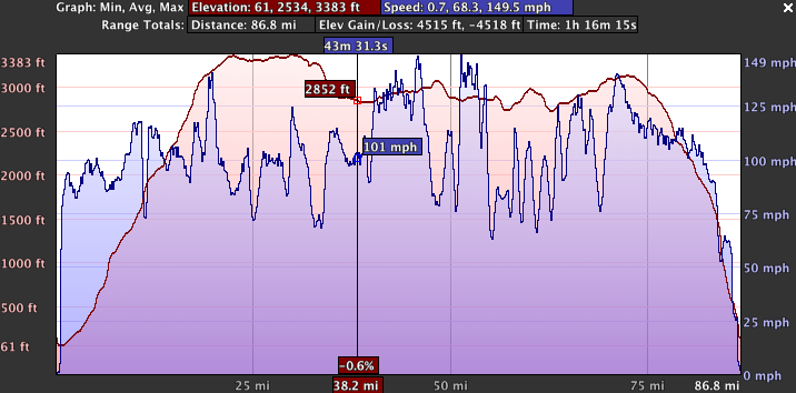
I’ve always been a data fan (my inner geek calling!) but I think this will be particularly useful during later lessons when practicing the circuit, and then reviewing my cross-country routes…
Hi,
Great fan of your blog – really useful as I am only in the early stages of my PPL at the moment.
My question is – I have used the GPS tracker that you suggested and the track and speed have worked perfectly. Unfortunately the altitude is way out and doesn’t represent the flight at most points. Do you have any tips on setting this up correctly?
Cheers,
Richard
Thanks for the feedback – glad to hear you’re finding the blog useful.
How far out is the GPS altitude log, compared with the altitude in the cockpit on your altimiter? Is it consistently out?
GPS measures the altitude above sea level. The altimiter measures the altitude above a set point – usually either above sea level if you’ve set QNH, or height above the ground if you’ve set QFE… If you’ve set the regional pressure setting (RPS) then the difference between the GPS and Altimiter could be substantial…