Monthly Archives: August 2014

Lessons 37 & 38: Revision

Cross country complete, 43 hours logged, and my instructor says I’m nearly ready to take the skills test. To get ready, we’d spend a couple of lessons brushing up and practicing various things we’ve previously covered – such as stalls, steep turns, and PFLs.

It’s a requirement that each student has logged 1 hour of instrument flight (with screens up) before they can have a PPL, and so I needed to get that logged too . Although I had flown with screens up already, this was usually just for part of a flight and so hadn’t been logged specifically as instrument flight. So we’d do a whole lesson with the screens up and log it as such.

Practicing stalls (or rather, stall avoidance and recovery) went well – you need to remember the first recovery action is always to lower the nose. We then did a couple of 45 and 60 degree steep turns. I’d forgotten just how much you need to pull back on the yolk as you enter a steep turn, so the first one wasn’t exactly level, but after that they were all nice and consistent.

We practiced a couple of PFLs from around 2500ft, then an EFATO during the climb-away. Wind was reported as calm, which meant picking a field was super easy! If only I could order calm wind for the day of my test…

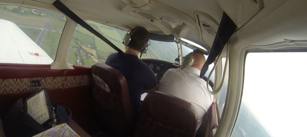
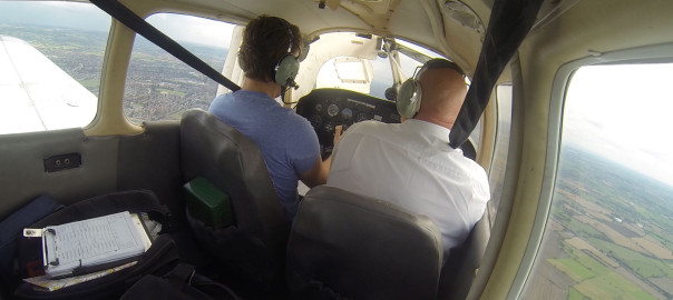
The instrument flight lesson went well. We had the screens up the entire time (my instructor was the lookout) – quite an interesting (and weird!) sensation taking off without being able to see the runway!

With the screens up, we practiced various methods of position fixing, as this is one of the things I’ll need to do in the test. The plane we were in didn’t have a VOR, but it did have an ADF and a DME, so we could use those.

As a recap, when using a nav aid you need to TITS (!) – Tune, Ident, Test, Sensible.

Position fixing using an ADF involves using the OBS knob to align your current heading to the top of the instrument. The arrow of the needle points to the heading to the station, so conversely the tail is pointing to the direction to the plane FROM the station. Remembering that ADF uses magnetic headings, we take the heading from the tail, convert from magnetic to true, and then plot a line on the chart. The DME gives us the distance along the line.

This worked out well. To confirm, we made a couple of radio calls. Firstly, we asked for a True Bearing – this was within 5 degrees of what I had calculated from the ADF, which allowing for the inaccuracies of both processes seemed pretty good.

We then practiced some rate one turns – turning 180 to simulate what you’d do if you accidentally flew in to cloud.

Finally, we used the ADF to home back to the airfield. We flew over the overhead so that I could see the ADF in its ‘cone of confusion’ – the area within about 0.5nm of the NDB where the ADF gets confused and spins around, not knowing which way to point. Once we’d flown past the airfield, we used the NDB to position us for a long final join…

Runway 22 was active, and we were flying East over the airfield. Therefore we turned to a northerly heading, set the OBS to 000 and waited until we were about 3nm DME. At this point I turned to 310 (heading of base leg), set the OBS to 310. We then know exactly when we are on the extended centreline, as it’ll be when the ADF is pointing at 220. We then turned to 220 and everything was lined up. The screens came down at about 1.5nm out and I landed visually as normal.

After the flight, we had a quick debrief and my instructor suggested I should take a mock skills test next time. As it happened, my instructor would be on holiday for the next two weeks, so this works out quite nicely – it means I can take the mock test with a different instructor, giving me a more realistic experience as the actual skills test will be with an examiner I have never flown with.

Lesson 36: Qualifying Cross-Country (QXC) Gloucester -> Cardiff -> Wolverhampton Halfpenny Green -> Gloucester

The day had finally arrived – it was time to do my Qualifying Cross Country (QXC) flight. The weather was great – sunny, good visibility and a high cloud base, so things were looking good.

I’d planned my route, Gloucester to Cardiff, Cardiff to Wolverhampton Halfpenny Green, Halfpenny Green to Gloucester using a direct straight line, as there were no NOTAMS, danger areas or airspace along the route that needed to be avoided.

Before leaving the airfield, I had a brief with my instructor, covering all the “what if’s”, such as radio failure, airfield closures, deteriorating weather, getting lost, etc. After he was satisfied with my responses, we signed the declaration form and it was time for me to head to the airplane.

I performed the A-check, everything looked good so I was soon inside the cockpit with the door latched and my harness tight. Runway 04 was in use today, so after departure I made a turn to the left to obtain my heading of 235 degrees. The navigation to Cardiff was straight forward, in part because I had flown the route twice before, and also because the route basically just hugs the shoreline the entire way down.

My initial radio call to Cardiff Approach went well. I was given a Squawk, they  identified me and gave me a basic service. A couple of miles later and I was cleared to enter their controlled airspace via the Published VFR Cardiff Docks Arrival route – the same one as I’d used in my previous two trips. Runway 12 was active, and on transferring to Tower I was told to join downwind. The landing went well (there was a fairly strong cross wind, and I landed a metre or two from the centre line, but given the runway is so wide it wasn’t a problem) and I taxied to Aeros for a coffee and to get my QXC certificate signed.

When Aeros phoned Tower to check they were happy to approve my QXC form, Tower did say that I had forgotten to report Downwind but apart from that they were happy, so my form was signed. Not sure how I managed to forget that – must of been the heat of the moment – but at least they were happy with everything else.

Selfie at Cardiff, see the departing plane in the background!?

Shortly after, I was back in the cockpit and preparing to depart for Wolverhampton. I was given the Published VFR Wenvoe Departure, as before, which is basically a reversal of the Docks arrival. Again, the en-route part of the flight went well and was non-eventful.

En-route selfie
En-route selfie

I switched to Halfpenny Green Information about 20nm from the airfield, they then provided me a basic service until I was 10nm and asked for join instructions. They asked what join I’d prefer, and as runway 34 was active I took a direct join on long final. I was number 3, with the 2 ahead also joining long final. I was visual with them both so was happy to follow behind for a straight-in landing.

After landing, I went up to the cafe for some refreshments. They were as miserable and unfriendly as when I visited last, so I didn’t hang around very long! I walked up to the Tower, had a brief chat with the guys there and they signed my QXC form. No issues.

Wolverhampton Halfpenny Green Tower

The flight back to Gloucester went smoothly, I made a standard overhead join for 04 and was soon back on the ground. I managed to achieve my QXC flight without any issues, so it was time for celebration. As it was the end of the day, a bunch of us from the flying club went to the Aviator (the airfield pub/restaurant at Gloucester) for a drink and some food. It was also my birthday, so I had two excuses to celebrate 🙂

Celebratory pint :)
Celebratory pint 🙂

Unfortunately, my GoPro footage lacked any cockpit audio for the flight. It looks like the USB connection cable in to the GoPro must have bent in my last flight, so the signal isn’t making it through. Very annoying, as I’ll need to buy a replacement cable and they’re not cheap! Still, a really great day and one that I’ll remember for a long time to come…

Here’s the SkyDemon logs for each leg:

Gloucester to Cardiff
Cardiff to Wolverhampton

Wolverhampton to Gloucester

Wolverhampton to Gloucester

Overhead join at Wolverhampton Halfpenny Green Airfield for Runway 04

Lesson 35: Gloucester to Wolverhampton dual land-away

Today (June 14th) was a lovely sunny day, and it was also the day of Flyer Magazine’s 20th Anniversary Fly-In, which happened to be at Gloucester Airport and hosted by Aeros. So before my lesson, I arrived a little early to join in the celebrations. There were lots of people, lots of new planes on the apron, and – most importantly – a hog roast!

Whilst eating the rather lovely hog roast, I got chatting to a nice young chap called Will. He’s also learning to fly and has the same instructor as me. Despite having around 20 hours logged and being on the Navigation part of the PPL, he hadn’t yet flown solo. You need to be 16 before you can fly solo, so he was counting down the months until his next birthday. How frustrating must that be! He shown me some of the photos he’d taken whilst up in the plane, and they were really impressive. I said he should start a blog 🙂

Flyer Anniversary Fly-In at Gloucester
Some of the people enjoying the hog-roast and a good old natter

After a second portion of hog roast, my instructor and I were talking through today’s lesson. We’d fly to Wolverhampton Halfpenny Green together, another new airport for me. The significance of flying here is that when I do my Qualifying Cross-Country flight, it’ll be from Gloucester to Cardiff to Wolverhampton to Gloucester, so it would be good to check out the place together first.

There were some NOTAMS covering Tewkesbury and the surrounding area, meaning the straight line route between Gloucester and Halfpenny Green would be no good. Instead, I planned to fly North West to Ledbury, turn there and head North East direct to Halfpenny Green. Estimated time in the air: 19 minutes.

Planning complete, time to check the aircraft. I hadn’t flown this aircraft before, and the interior decor looked a bit like stepping into a living room from the 1970s!  I did the A-check and everything was fine, so very shortly after I had the engine running and requested taxi. The airfield was busy because of the Flyer fly-in, but after a short wait we were cleared to take-off and I was climbing out from runway 04.

I headed to Ledbury, turned, and then flew directly to Wolverhampton, changing frequency from Gloucester Approach to Hapney Green Information at Worcester. Runway 04 was active, with left hand circuits, and I joined by making a standard overhead join. The landing was relatively successful (although I was a little low towards the end) and we parked up and got out to have the obligatory coffee.

Here’s a clip of me downwind, turning base and then landing:

I don’t know if they were having a bad day or what, but the staff in the café seemed pretty miserable – the service was dreadful and so we didn’t feel like hanging around too long! We drank our drink, headed up to the tower to pay the landing fee and went back to the aircraft.

I’d planned our route back to be via Evesham, avoiding the NOTAM area previously mentioned and giving us some different scenery. The flight back was pretty uneventful, and by the time we were near Gloucester nearly all the fly-in traffic had left, so we were able to land without much waiting around.

I was back in Gloucester in time for the evening Flyer celebrations at the Jet Age Museum (located within the airfield). I hadn’t visited before, and am glad I did – it has some cool stuff in there and is definitely worth checking out next time you’re in Gloucester. You can even taxi and park there.

Ian Seager, the publisher of Flyer, gave a short speech (looking at the journey over the last 20 years) and there was plenty of bubbly and canapes. A great celebration. He looks nothing like the photo in the magazine!

Next lesson will be… my solo qualifying cross country flight!

Lesson 34: Radio navigation and diversion practice

For today’s lesson, we wanted to cover:

  • Position fixing
  • Radio navigation using the VOR
  • Radio navigation using the ADF/NDB
  • Diversions

Position fixing is one of the (many!) things that will be in the skills test, but is also an important thing to be able to do incase you become ‘temporarily uncertain of position’ (lost).

There are lots of ways to identify your position, including asking the radio service for a True Bearing (or QTE) or Magnetic Heading To Station (QDM). If you get a QTE, simply plot the line on the chart and you will be somewhere along that line.  With a QDM, you first need to convert magnetic to true, then plot the reciprocal (as QDM is direction to station).

However today we would be looking at position fixing using radio navigation aids – the VOR, ADF/NDB and DME.

VOR is short for VHF omnidirectional range, and is technology that dates back to the 1940s but is still in wide use today. To use a VOR, you need a VOR receiver in your aircraft. You then need to be in range of a VOR station. There are many across the UK and they have a fairly long range so this shouldn’t be much of an issue. To use one:

  • Tune – the nav radio to the VOR frequency
  • Ident – listen to the morse to check you are receiving the right station, and that it is in service
  • Twist – check the warning flag is out, and twist the OBS knob 360 and check you get the FROM and TO flags accordingly, then set the desired radial
  • Sensible – does the indication seem sensible?

The direction flag is really important. If you wanted to fly along the 090 radial from a VOR, you’d make sure you had the FROM flag displaying. If the needle is to the left of centre, you turn left until the needle centres. If you want to fly TO a VOR, you’d make sure the TO flag is set.

So, we can use this to identify the radial we are over. Tune and ident, then twist until the flag is on FROM and the needle is centred. Lets say it is centred on 070. We are somewhere along the line of the 070 radio from the VOR. Most VORs also have a DME (distance measuring equipment) which gives us the distance from the VOR. We can then plot the distance along the line to get our exact fix. Alternatively, tune to any DME in range, get the distance and plot it on the chart, which should be somewhere along the line you’ve drawn.

We could also identify our position without a DME, but this would require to VORs. First, we’d plot the radial from VOR1 and then plot the radial from VOR2. Where the two radials cross, that is where we are.

On the other hand, the ADF (Automatic Direction Finder) is a simpler instrument that points towards the station (an NDB, non directional beacon). To use one, again use the TITS mnmemonic – tune, ident, test (there is usually a test button on the DME), sensible – is it pointing in the direction we expect?

To use an ADF for position fixing, make sure you’re flying straight and level. Then twist the heading dial on the ADF to match your current heading. The arrow on the ADF will be pointing to the heading you need to fly TO the NDB. To plot our current position, simply take the reciprocal (the tail of the needle) on the chart from the station. Again, with a DME we can then plot our exact position along that line.

I’ve covered Diversions before, but to recap – make sure you plan the diversion from a known point. Draw a line between the two points. Estimate (or ideally measure) the angle, convert from degrees true to magnetic, correct for wind drift, then fly the heading. Make a note of the time in your PLOG. Next, measure the distance and calculate how long it will take (allowing for wind). Update the PLOG with an ETA. Mark off the quarter/half/three quarter way points, and look for distinguishing features along the route. Keep looking out to make sure you are on track.

The flying went well – we flew out of Gloucester towards May Hill (West) then tuned to the Brecon VOR. I fixed our position using the VOR – we were on the 075 radial FROM brecon, at 32 miles.  Then we flew along the 075 radial for a bit, by flying TO the 255 radial. After about 10 miles, we flew north. We wanted to intercept the 065 radial FROM the vor, so that we can track it towards Ross on Wye. Flying North, I tuned 065 FROM in the VOR and waited for the needle to center. Then I turned to a heading of 065 and kept it centered. After about 5 miles we were over Ross. Pretty cool.

I then had to divert from Ross to Bromyard, which required a heading of 010, and at 16 miles was estimated to take 10 minutes. I had the Ledbury aerial mast, and the towns of Hereford and Ledbury either side of me to confirm my position along the route, as well as the high ground, M50 motorway and a railway line. Sure enough, after 10 minutes we were right over Bromyard (or about 1 mile to the right of it, to be exact – but pretty darn close).

Diversion complete, we used the ADF to position fix and verify that we are actually over Bromyard. So I tuned to Gloucester’s NDB, ident and tested, then aligned the dial to our heading. The tail of the needle was pointing to 320, which I drew on the chart. Sure enough, that line goes straight through Bromyard. Our DME was out of service, so I couldn’t verify it exactly, but I was confident it was correct.

As if by magic, our engine caught fire (well, not really – the instructor pulled the throttle back to idle and told me to carry out a practice engine fire drill). First things first – fuel off, throttle closed, mixture ICO, fuel pump off, heater/demist off. Then carry on as if it was a normal PFL – trim for 73, identify a field, MAYDAY call, Squawk 7700, mags off, seat belts tight, door unlatched, master switch off, first stage of flaps when you are confident you’ll make it to 2/3rds along the landing point, second stage when you’re confident of reaching 1/3rd, then.. then we climbed away. All good except it took me a while to remember the initial steps. Must learn them some more.

We then put the screens up and I practiced instrument flight back to about 5nm from Gloucester, where I joined right base for runway 27.

Next lesson will be a dual nav exercise to Wolverhampton Halfpenny Green.